Geomorphologic characterization with soil and geological hazard study,
Punta Arenas city, Magallanes and Chilean Antarctic region


Introduction
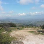
The Ministry of Public Works ask for a geomorphological study in the basins that drains to Punta Arenas city. This study is framed within the consultancy for the Actualization of “Evacuation and rainfall drainage evacuation Master Plan at Punta Arenas”, requested by Hydraulic Works Management Department.
In particular, this advisory has the objective of characterize geomorphological units and soil type in the basins, identifying the mass removal deposits and potential sites where it can be produced.
Methodology
The following activities were conducted in order to accomplish the objectives:
- Gathering and analysis of records.
- Geomorphological and geological characterization.
- Geological, edaphological and geomorphological field recognition.
- Geologic hazards analysis.
- Final report.
Products
The handed product from this study consisted on a Final report that shows a geomorphological and geological characterization on a 1:25.000 scale map altogether with a slopes map, infiltration analysis and soil types, vegetal cover and surface storage. These all were integrated to define hazard zones.